In the past week there has been extensive media coverage and headlines about "the worst California drought in 1200 years". This was based on a paper to be published in Geophysical Research Letters by the AGU. However a thorough reading of that paper,"How unusual is the 2012-2014 California drought?", indicates that this "worst" declaration should have at least a few asterisks. The article is not inaccurate but it takes only a limited view at looking at the current California drought.
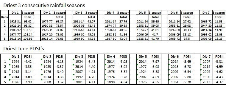
- The study defines drought using the Palmer Drought Severity Index (PDSI). This is an agricultural index, based on soil-moisture as a function of both temperatue and precipitation. While, agriculture is incredibly important in California, it is not necessarily the best metric for the state's overall water deficit and its impacts.
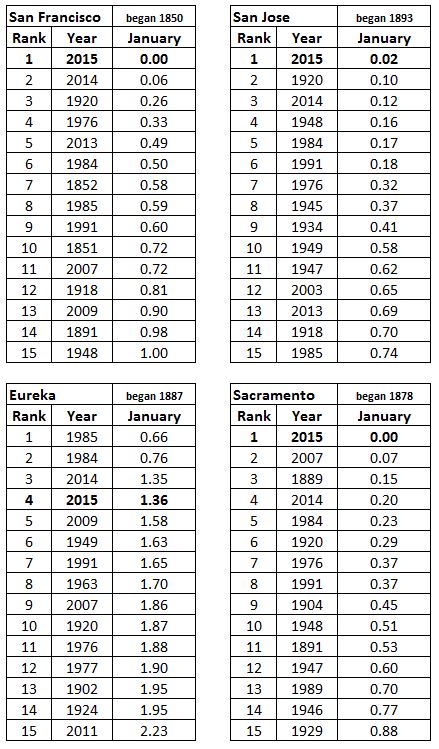
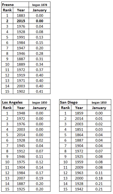
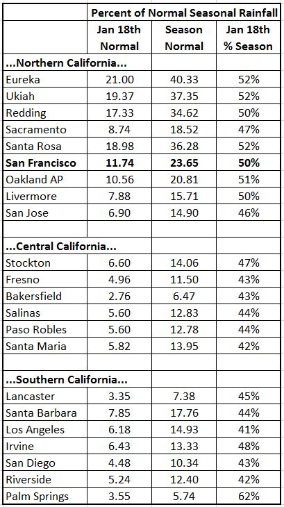
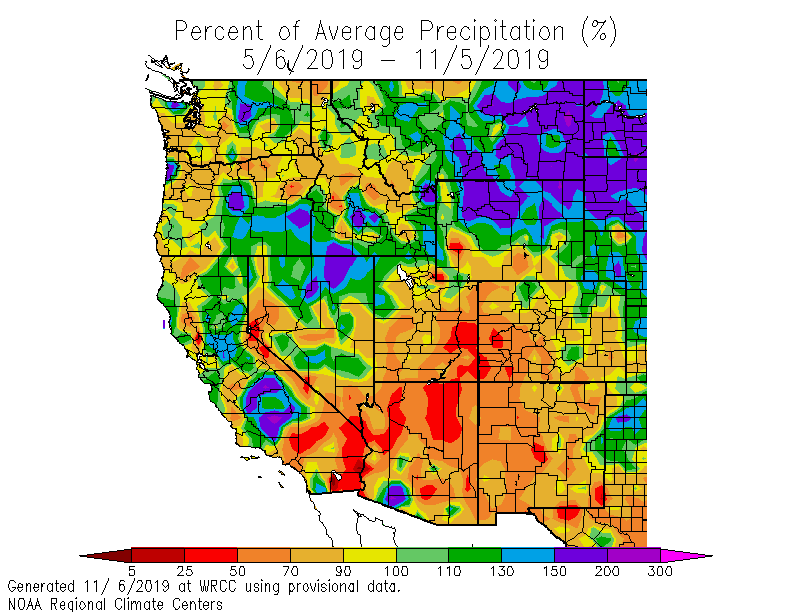
- The paper also does not look at all of California. Instead it only examines the PDSI for central and southern California (i.e. NCDC California Climate Divisions 4, 5, 6, 7). This methodolgy gives a skewed prespective since much of the water used throughout the entire state originates in northern California (i.e., Climate Divisions 1,2,3) and the 3-year deficit has been less there than in the sampled southern two-thirds of the state. [For additional context see the just released NOAA California Drought Assessment.]
The bottom line is that the paper really only speaks to agricultural drought in central and southern California while both the Ranked 3-year Precipitation and PDSI show that currently the drought in northern California is only on the order of the 4th or 5th driest in the past 120 years; certainly not the driest in the past 1200 years statewide.
Jan Null, CCM
Golden Gate Weather Services

